
TRM-GPS6 Handheld Network Weather Station
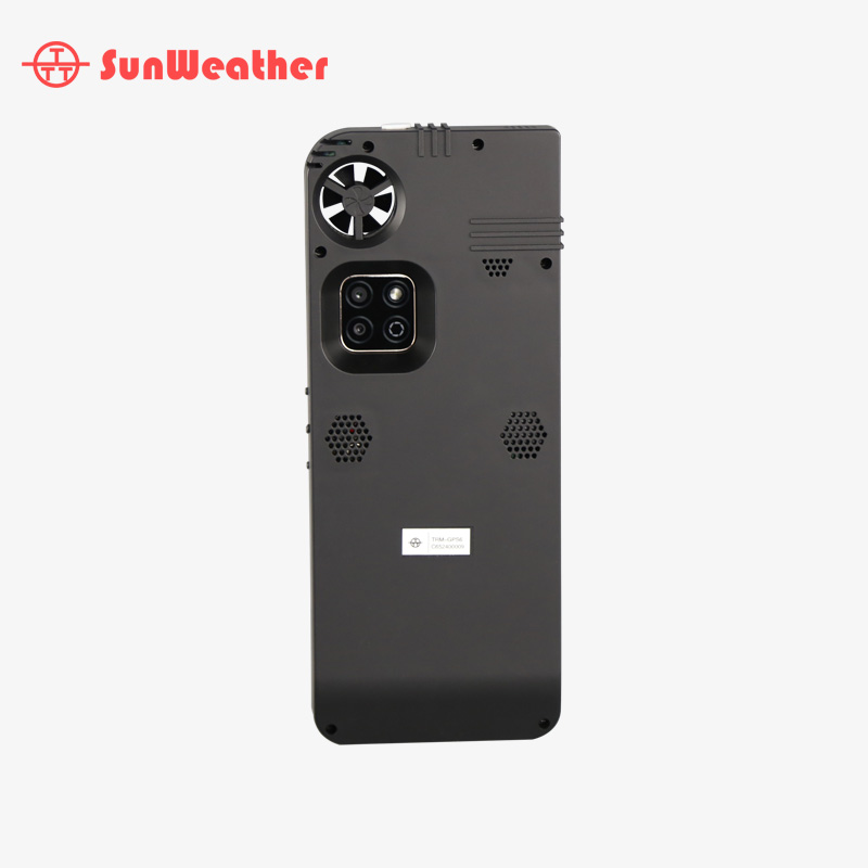
TRM-GPS6 Handheld Network Weather Station
Payment:
T/T, L/C or Paypal
OEM/ODM:
Available
MOQ:
1PCS
Model:
TRM-GPS6
Lead Time:
5-7 days
PRODUCT DESCRIPTION
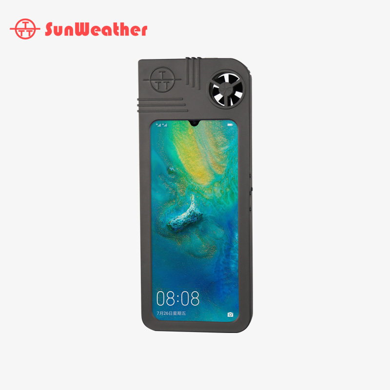
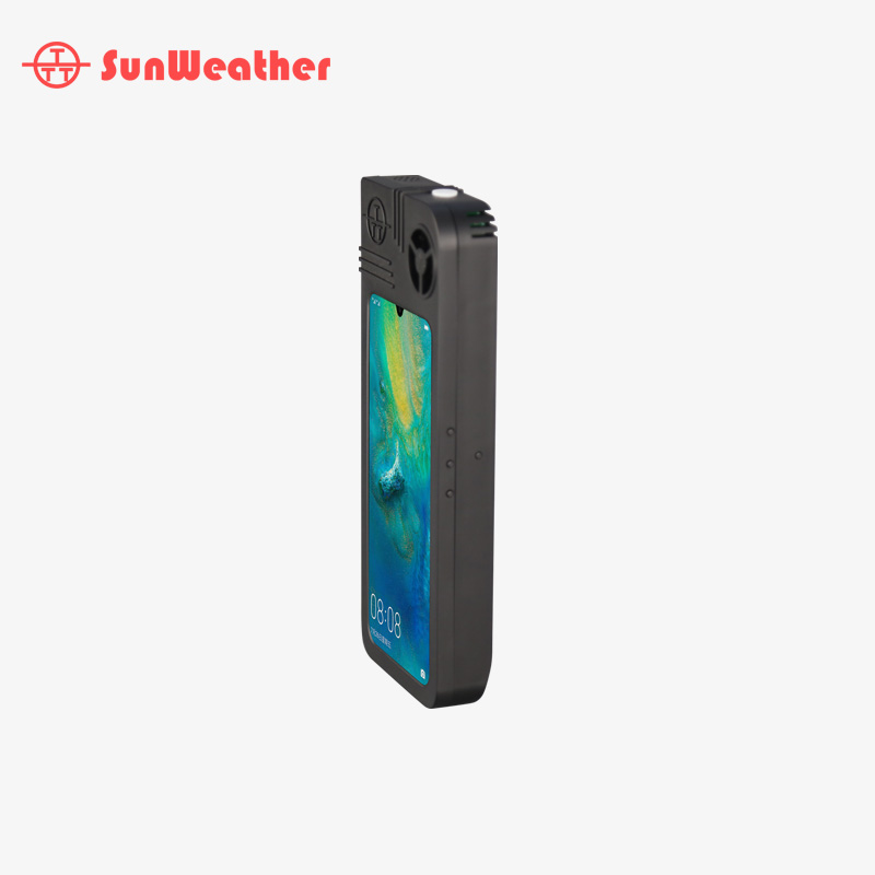
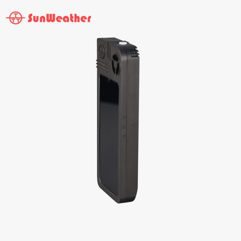
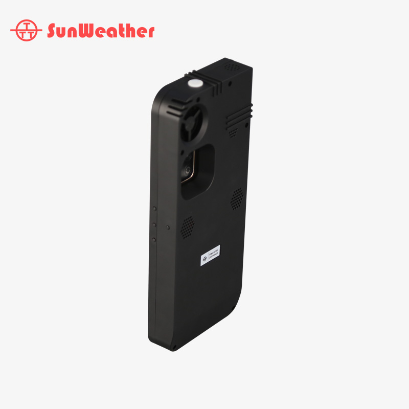
The TRM-GPS6 handheld weather station is the fourth-generation portable automatic meteorological station developed by our company. It is primarily designed for meteorological observations under portable conditions.
This device features high measurement accuracy, stable and reliable performance, compact size, lightweight design, and easy portability. It can be directly handheld for on-site observation, offering exceptional convenience.
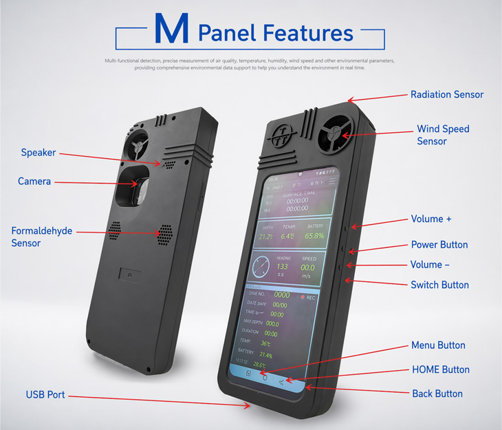
The system is capable of automatically measuring a wide range of meteorological parameters, including ambient temperature, humidity, dew point, wind speed, wind direction, solar radiation, air quality, PM2.5, PM10, formaldehyde, atmospheric pressure, altitude, as well as current longitude and latitude.

All-Solid-State Integrated Design

Flexible Multi-Parameter Monitoring

High-Precision Ultrasonic Wind Measurement

Portable & Versatile Operation

Smart Connectivity & Data Display

Long Battery Life & All-Weather Performance
Technical Specifications & Product Features
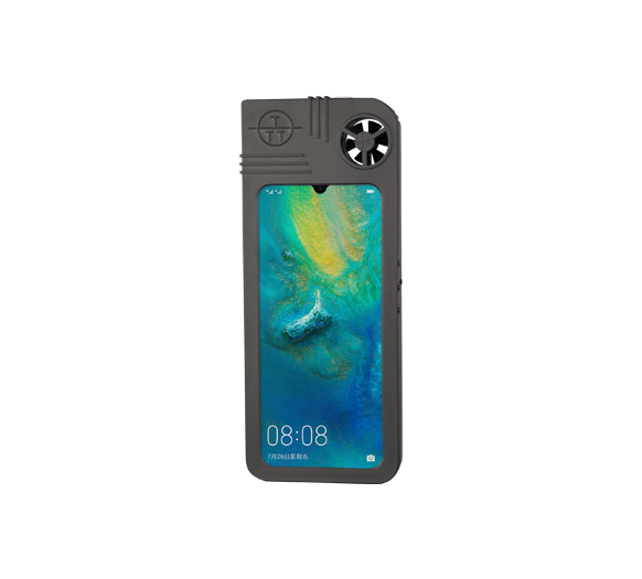
- The device features a 6.5-inch narrow-bezel HD full-screen TFT LCD display with 16.7 million colors. It delivers high-speed response, high brightness, and high contrast for clear and vivid visuals, with excellent animation performance for a fully intelligent human-machine interaction experience. With a sleek 20:9 aspect ratio and TÜV Rheinland low blue light certification, it provides enhanced eye comfort and reliable, all-day usability.
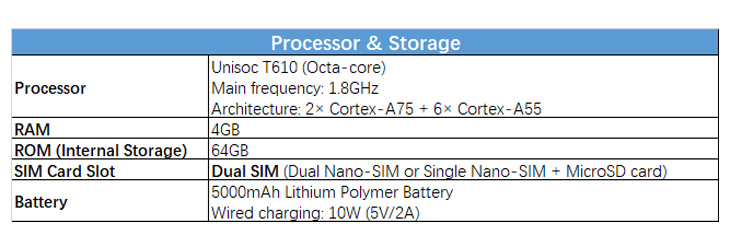
2. Powered by the Unisoc T610 processor, built on a 12nm process, featuring an octa-core architecture (2× Cortex-A75 + 6× Cortex-A55) with a maximum frequency of up to 1.8GHz. Equipped with an ARM Mali-G52 3EE dual-core GPU running at 614.4MHz, delivering smooth and efficient graphics performance. The system runs on Magic UI 4.0 based on Android 10, offering a rich and versatile user experience. It combines the performance of a smartphone with the functionality of a computer, along with integrated meteorological data measurement capabilities. With 4GB RAM and 64GB storage, it ensures ample capacity for continuous meteorological data recording—making it a powerful handheld weather computer.
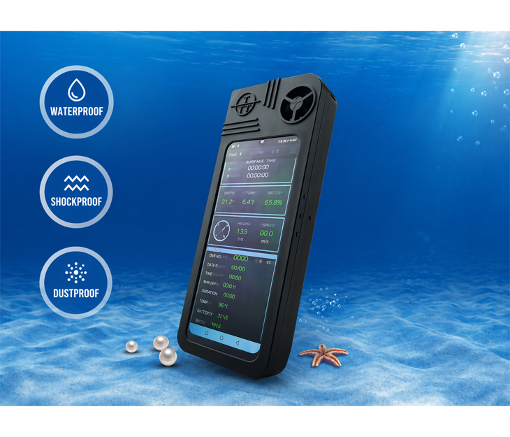
3. The device features a rugged triple-protection design (splash-proof, shock-resistant, and dustproof). Key components are engineered to meet waterproof protection standards, ensuring reliable performance even in harsh and demanding environments.
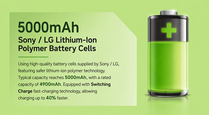
4. Power Supply: Powered by a continuous DC charging system, the device is equipped with a built-in 5000mAh lithium-ion polymer battery (with support for external battery expansion to extend standby time). Operating time during measurement exceeds 24 hours, while standby time exceeds 10 hours with all system functions enabled (including GPRS network, GPS, measurement, Bluetooth, and communication standby).
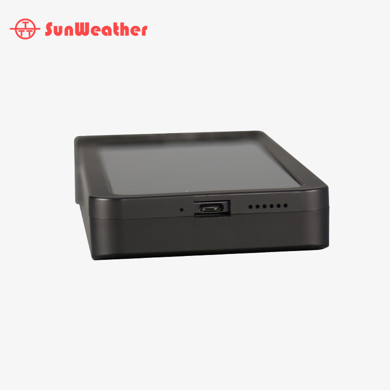
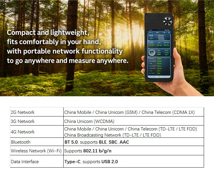
5. Connectivity is a key feature of this product. It supports mainstream wireless communication technologies, including Bluetooth and Wi-Fi, as well as wired USB connectivity, ensuring flexible and reliable data transmission.
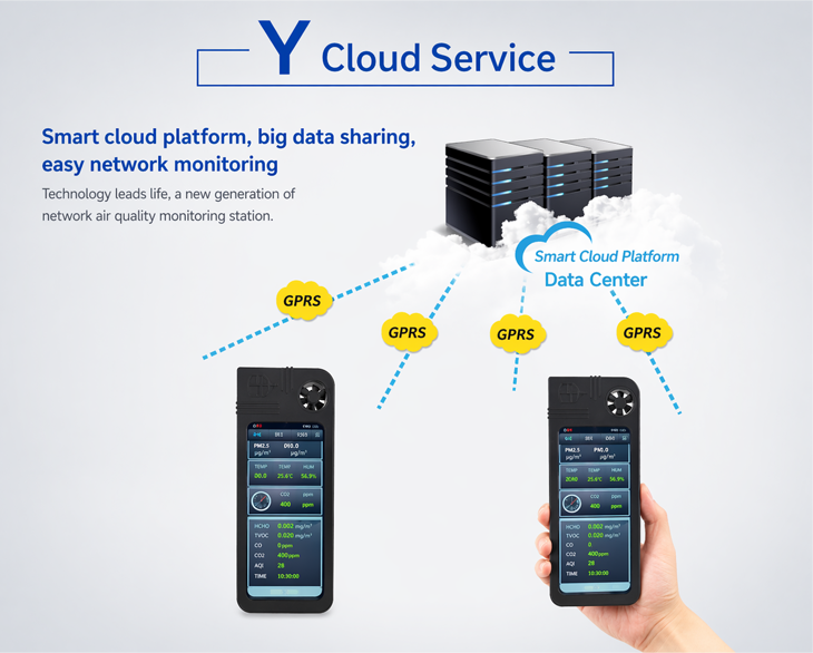
A. It is not only a handheld weather station, but more importantly a networked system. Multiple devices can be interconnected, enabling headquarters to monitor data from all locations in real time. With mobile networking capabilities, each unit is no longer isolated—creating a powerful, connected information network.
B. Compact and lightweight, it fits comfortably in your hand and is easy to use. With portable network functionality, you can measure anywhere, anytime—wherever you go, the network follows. Leveraging network resources, the device delivers powerful performance, making it a truly advanced handheld network product—far beyond traditional weather stations.
6. Powerful Features Beyond Conventional Handheld Devices
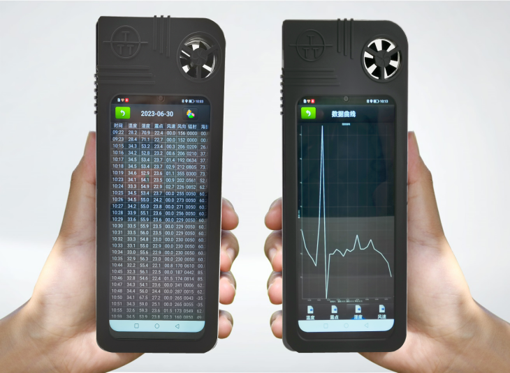
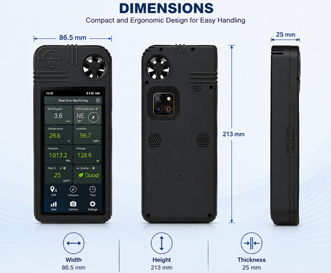
This device offers an extensive range of measurement capabilities, including: wind speed, wind direction, ambient temperature, humidity, atmospheric pressure, solar radiation, wind chill, heat index, dew point, altitude, GPS location (latitude & longitude), electronic compass, and time. It also supports advanced environmental monitoring, such as air quality, PM2.5, PM10, and formaldehyde detection. Additional functions include: photo and video capture, mobile calling capability, GPRS wireless data transmission, and cloud-based data platform integration.
7. Mobile Communication Functions With integrated smartphone technology, the device offers full mobile phone capabilities and functions much like a compact computer. It supports features such as voice calls, SMS messaging, weather forecasts, and popular messaging/chat applications, among others.
8. System Software Functions The professional network-based software enables real-time monitoring of data from multiple weather stations within the system. Wherever the device operates, the central platform can track measurement time, location, and real-time environmental data. The system fully complies with national standards for automatic weather stations, offering a user-friendly interface with intuitive graphical data display. It runs on Windows 2000 or later, supports connection to a printer for automatic data printing and storage, and stores data in Excel-compatible format. The software can also generate meteorological data charts, allowing seamless integration with other applications.
9. Operating Environment: Temperature: -45.0 to 60.0°C Humidity: 0.0 to 100.0% RH Pressure: 300.0 to 1100.0 hPa
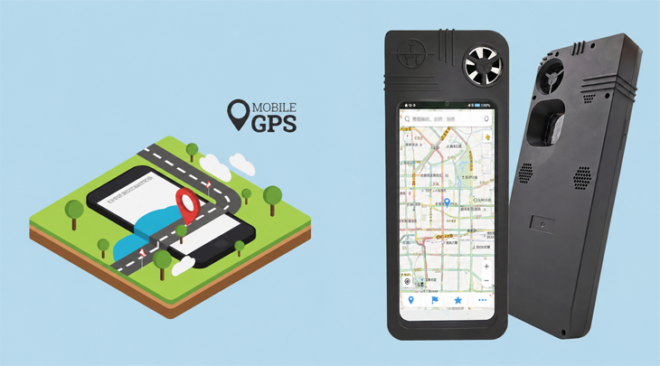
10. Electronic Map Function This device not only monitors meteorological data but also integrates an advanced electronic mapping system. Compared with traditional maps, electronic maps can display far more detailed information. While conventional maps use simple lines and symbols to represent roads and their classifications, electronic maps use X-Y coordinates for precise positioning and include rich attribute data for each route. For example, different values can indicate road types such as highways or national roads. Each road can carry multiple attributes, including road classification, name, surface material, start and end points, width, length, and traffic flow, providing a much more comprehensive and accurate representation than traditional maps. By combining weather forecasting data with electronic mapping, this product greatly enhances convenience and efficiency for users during travel.
Technical Specifications
Parameter | Response Time | Measurment Range | Resolution | Accuracy | Operating Environment |
|---|---|---|---|---|---|
Wind Speed | 1 s | 0.4–40.0 m/s | 0.1 | ±3% | 0.4–60.0 m/s |
Wind Direction | 1 s | 0–360° | 3° | ±3° | 0.4–60.0 m/s |
Ambient Temperature | 1 s | -40–80°C | 0.1 | ±0.2°C | -40–60°C |
Relative Humidity | 1 min | 0–100% RH | 0.1 | ±3% | 0–100% RH |
Solar Radiation | 1 s | 0–2000 W/m² | 1 W/m² | ±5% | |
PM2.5 | ≤90 s | 0–500 µg/m³ | 1 µg/m³ | ±2% | -20–40°C |
PM10 | ≤90 s | 0–500 µg/m³ | 1 µg/m³ | ±2% | -20–40°C |
Formaldehyde (CH₂O) | 1 min | 0–5 ppm | 0.1 ppm | ≤0.02 ppm | -20–50°C |
Atmospheric Pressure | 1 s | 300–1100 hPa | 0.1 | ±1.5 hPa | 300–1100 hPa |
Altitude | 1 s | <6000 m | 1 m | ±15 m | -2000–9000 m |
Dew Point | 1 min | Depends on RH & Temp | 0.1 | ±0.2°C | 0–100% RH, -40–60°C |
Electronic Compass | 10 s | 0–360° | 3° | ±3° | Non-magnetic interference environment |
GPS (Built-in Antenna) | Hot start: 10 s Cold start: 120 s | Longitude, latitude, time, altitude, satellite count | 0.1 | Position accuracy: ≤5 m (50%) | -40–60°C (outdoor) |
Camera | Rear: 13 MP / Front: 5 MP | ||||
Mobile Communication | 4G, dual SIM standby | ||||
Data Communication | GPRS / Bluetooth / WiFi | ||||
Cloud Platform | Sunshine Smart Cloud (Alibaba Cloud-based, stable, secure, fast transmission) |
Package Contents
Item | Number |
TRM-GPS6 Portable Network Weather Station | x1 |
TRM-GPS6 Monitoring Software | x1 |
Data Communication Cable | x1 |
Lithium Polymer Batteries (5000mAh + 2000mAh) | x2 |
User Manual + Certificate of Conformity + Warranty Card | x1 |
